Mount Wuyi, Danxia Peaks and Rock Tea in Northern Fujian
Mount Wuyi is why travelers stop in Nanping. The name covers a mountain range on the Fujian–Jiangxi border and, more usefully for visitors, the scenic area around Wuyishan city with red sandstone Danxia cliffs, the Nine-Bend Stream and tea valleys. UNESCO listed Mount Wuyi as a mixed World Heritage site in 1999 for culture, scenery and biodiversity. Chinese materials on the scenic area date its modern park administration to 1979 and place it among the first national key scenic areas in 1982. Yanping district is mainly the prefectural hinge. Protect the mountain day.
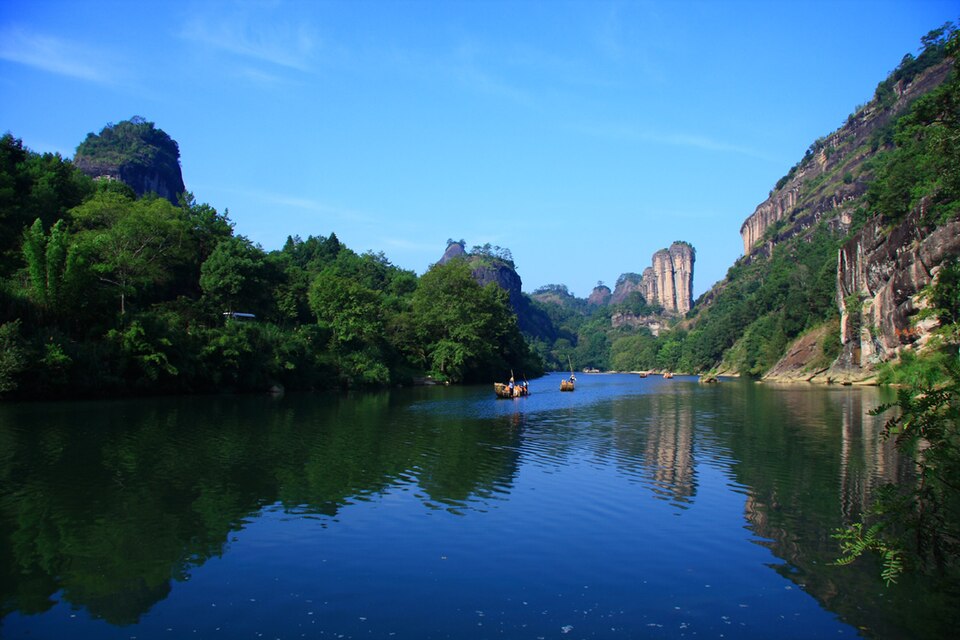
Landscape and heritage
English Wikipedia describes winding river valleys, columnar and dome-shaped cliffs, and elevations from about 200 metres up to Mount Huanggang at 2,158 metres on the provincial border. Eastern peaks in the tourist belt are classic red sandstone Danxia with steep sides and flatter tops. The heritage property includes the Nine-Bend Stream ecological area, nature reserves and a small Han-dynasty remains protection zone, with a large buffer around the cores.
Human settlement on the slopes goes back thousands of years. Cliff burials, Song academies and Taoist and Buddhist sites sit among the peaks. Neo-Confucian scholar Zhu Xi taught here. Rock tea, especially Da Hong Pao, is the living agricultural fame of the cliffs. The Impression Da Hong Pao landscape show is an evening option when you want theatre after the mountain day; skip it when raft plus peak already filled the clock.
Tianyou Peak and the climb-for-view half-day
Tianyou Peak is the climb most visitors pair with the raft. Stone steps lead to pavilion viewpoints over the stream bends and Jade Girl Peak. Clear mornings repay the stairs; heavy rain makes rock slick. Chinese scenic writing groups Tianyou with the Yunwu (cloud nest) area as one of six modern scenic clusters, alongside Nine-Bend, Wuyi Palace–King Peak, Tiger Roaring Rock–Thread of Sky, Water Curtain Cave–Da Hong Pao, and Yulin Pavilion–Lotus Peak.
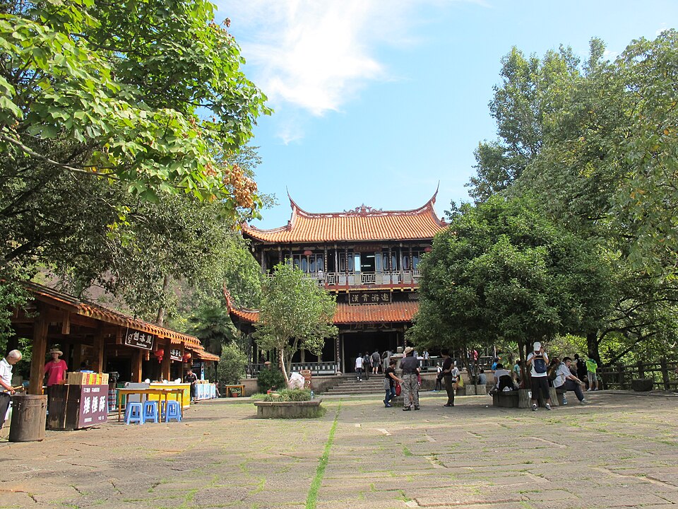
Thread of Sky (One-Line Sky) and Water Curtain Cave are optional geology half-days when legs remain. Visitor access to biodiversity-protection zones is controlled; stay on posted paths.
Tickets, shuttles and hours
Scenic tickets and shuttle buses are sold separately from the bamboo raft. Real-name ticketing has been in force since 2019 according to Chinese Wikipedia on the scenic area. Travel listings publish seasonal yuan prices that change; invent no fixed figure here. Check the day's official notice for entrance, shuttle and raft coupons before you book a same-day stack from Fuzhou or Hangzhou.
High-speed rail serves Wuyishan North and other Nanping-area stations; read the station name on the ticket. Scenic shuttles cover South Entrance, Tianyou, Da Hong Pao and related stops that are not one continuous walk. Confirm last shuttle returns before dusk. Stay in the Sangu / scenic-area belt if dawn rafts own the trip.
Northern Fujian summers are humid. Spring and autumn often give clearer peak views. Winter valleys stay open with layers; heavy rain can pause raft operations and make climbs unpleasant.
Pairing with the raft and tea valleys
Book the Nine-Bend Stream raft first, then fit Tianyou or tea walks around the sailing. The Nanping guide puts raft as the signature soft water half-day and Tianyou as the climb-for-view half-day. Da Hong Pao valleys are the cultural buffer when oolong framing is the thesis. One honest mountain spine beats stacking every side cave and tea theatre onto the same exhausted evening.
Before you go
- Book the raft slot before you lock the peak climb.
- Read station names: Wuyishan North is not Yanping city centre.
- Wear shoes with grip for stone steps after rain.
- Check last shuttle times before dusk walks.
- Confirm entrance and shuttle prices on the day's notice.
Frequently asked questions
Is Mount Wuyi a UNESCO site?
Yes. It was listed as a mixed World Heritage site in 1999.
Raft or Tianyou if I only have one half-day?
The raft is the signature soft stop. Tianyou is the viewpoint climb. Book whichever matches your mobility and weather.
How many days for Wuyishan?
Two days cover raft plus peak with a tea buffer. Three days add caves or a slower tea valley.
Can I drive between every peak?
Scenic shuttles cover the main stops. It is not one continuous walk from the South Entrance to Da Hong Pao.
Sources
Facts in this article were checked against the following sources, retrieved 13 October 2026.
- Wuyi Mountains, English Wikipedia
- 武夷山风景名胜区, Chinese Wikipedia
- Mount Wuyi, UNESCO World Heritage Centre
- 九曲溪, Chinese Wikipedia
Photos are from Wikimedia Commons under the licences shown in each caption.