Pingxiang Travel Guide: Wugong Mountain and Western Jiangxi
Pingxiang is the gateway to Wugong Mountain (Wugongshan), whose high grass meadows and cloud seas draw hikers from across southern China. The summit, Jinding or Baihe Peak, stands at 1,918.3 metres. From Pingxiang North high-speed station a direct bus reaches the scenic area's visitor centre in about 90 minutes, and two cable cars can lift you most of the way up. Plan one long mountain day, or better, a night on the summit, plus a travel day either side.
Choosing how to do Wugong
The mountain works three ways, and the choice decides everything else.
Cable car day. From the visitor centre a free scenic bus runs to the Shigu Temple trailhead. The first cable car (Zhong'an) climbs to the Ziji Palace area; a short walk links to the second (Jinding) cable car, which drops you near the summit. The scenic area's own guide puts this route at about two hours up. You then walk the meadows, the ancient stone altars at the top and the ring walkway, and ride down.
Hike up. The classic route from Shigu Temple climbs past waterfalls and the Haohanpo stairs to Diaomazhuang and Jinding. Allow five to six hours up. It is a stair workout more than a wilderness trail.
Overnight. The scenic area's recommended two-day plan rides up, walks the summit, continues along the Starry Sky Walkway to the meadow campsite and returns the next morning via Haohanpo. Staying up top is the way to see sunrise and, with luck, a sea of cloud.
Fares for the entrance ticket and both cable cars are published by the scenic area and change; check the official notice rather than trusting older figures you see online.
Places worth visiting
The summit meadows and Jinding
Above the tree line the ridge turns to open grassland that stays green through summer and goes gold in autumn. Mist rolls in and out quickly, which makes the views unpredictable. Local advice on cloud seas is simple: the morning after rain, when the cloud base sits below the summit's 1,918 metres, gives the best odds.
The stone altars on the summit
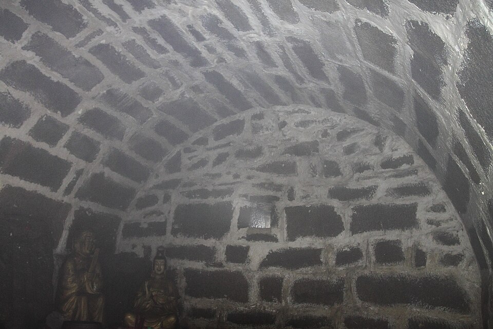
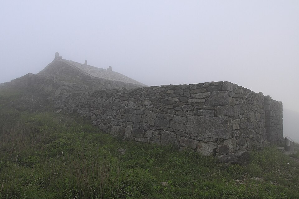
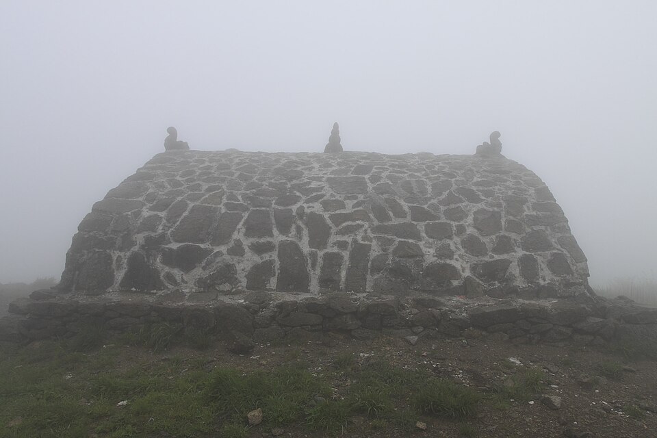
The groups of stone altars around Jinding are among the mountain's oldest structures, built for worship at the summit. They are small and weathered, easy to walk past in fog. Give them ten minutes; they explain why people were climbing this ridge long before the cable cars arrived.
Haohanpo and the stair route
Haohanpo, roughly "the brave man's slope", is the steep middle section of the hike. Coming down it is hard on knees, so many people ride the Zhong'an cable car for the lower half on the descent. Walking poles are sold cheaply at the base.
Anyuan and the city
Anyuan, in the city's east, was the site of the 1922 Anyuan miners' strike, a landmark of the early Chinese labour movement linked with Mao Zedong, Li Lisan and Liu Shaoqi. The memorial hall is the main draw for travellers interested in modern history. Most leisure visitors skip it, and that is fine.
When to come
April to June and September to November are the best months for walking. Late spring brings frequent rain and therefore more cloud seas; autumn gives clearer air and golden grass. Summer is the season for night climbs and summit camping, with thunderstorms on the exposed ridge. Winter can bring snow and ice and slower cable car hours. Weekends and holidays mean queues at the cable cars and full summit lodging, so book ahead or go midweek.
Getting in and where to stay
- High-speed rail: use Pingxiang North on the Shanghai–Kunming line. Changsha is the nearest big hub; Nanchang is farther east.
- To the mountain: a direct tourist bus runs from outside Pingxiang North to the Wugongshan visitor centre, about 90 minutes. A second service runs from the long-distance bus station opposite Pingxiang (conventional) Station, about 70 minutes. The visitor centre is roughly 45 km from the city.
- Inside the scenic area: the free shuttle from the visitor centre to the Shigu Temple trailhead takes minutes; the entrance ticket covers it.
- Where to sleep: hotels at the foot of the mountain make sense the night before an early start. Summit hotels and campsites are the reason to do an overnight; they cost more and fill up on weekends. Stay in Pingxiang city only if you are arriving or leaving by train late.
Eating in Pingxiang
Pingxiang food is spicy and close to Hunan cooking across the border. Lianhua blood duck, from the county of the same name, is the dish to try. At the mountain base there are farmhouse restaurants and stone-pot fish places; on the summit, food is simple and priced for its location. Carry water and snacks for the climb.
How to arrange the route
Two days: Day 1, morning train to Pingxiang North, bus to the mountain, cable cars up, summit walk, sleep on top. Day 2, sunrise, walk the meadows toward Diaomazhuang and descend via Haohanpo or the cable car, then bus back to the station.
Three days: add a night at the base before the climb, or a half day in Anyuan.
The mountain also borders Yichun and Ji'an prefectures, with other approaches from those sides. Nanchang and Changsha are the usual onward hubs.
What to cut if short on time
Cut Anyuan and the city first. If you have one day, take the earliest train, ride both cable cars and accept a shorter summit walk. Hiking both ways in one day is possible for fit walkers, but leaves no slack for fog.
Things to confirm before you go
- Entrance and cable car fares and operating hours on the official Wugongshan notice; hours differ between April to October and November to March.
- Bus departure times from Pingxiang North and the bus station.
- Weather and any closures for storms, snow or ice.
- Summit lodging bookings for weekends and holidays.
Frequently asked questions
Which station should I use for Wugong Mountain?
Pingxiang North for high-speed trains; the direct bus to the visitor centre leaves from outside. Conventional trains use Pingxiang Station, with buses from the long-distance station opposite.
Can I see Wugong Mountain in one day?
Yes, with both cable cars and an early start. An overnight on the summit gives a much better chance of sunrise and cloud views.
How long is the hike up Wugong Mountain?
About five to six hours from the Shigu Temple trailhead to Jinding on foot.
Sources
The facts in this article were checked against the following sources, retrieved September 23, 2026, and rechecked on October 20, 2026.
- Pingxiang, Jiangxi https://en.wikipedia.org/wiki/Pingxiang,_Jiangxi
- Wugongshan scenic area official site, transport guide http://wugongshan.cn/page/strategyList!info.htm?id=1273
- Wugongshan scenic area official site, ticket and cable car guide http://www.wugongshan.cn/page/strategyList!info.htm?id=1271
- Anyuan railway and mine workers' strike (Chinese) https://zh.wikipedia.org/wiki/安源路矿工人大罢工
- Wugongshan visitor guide, Tencent News (April 2025) https://news.qq.com/rain/a/20250421A0377Y00
Tickets change; this article does not quote yuan amounts, so check the official notice for your date.
All photos are from Wikimedia Commons, used under CC licenses or public domain; re-use requires attribution.
- pingxiang-wugong.jpg from File:Wugongshan jisi yizhi 8384.jpg, by Doctoroftcm, CC BY-SA 3.0
- pingxiang-wugong-2.jpg from File:Wugongshan jisi yizhi 8416.jpg, by Doctoroftcm, CC BY-SA 3.0
- pingxiang-wugong-3.jpg from File:Wugongshan jisi yizhi 8421.jpg, by Doctoroftcm, CC BY-SA 3.0