The Red Flag Canal, Linzhou's Canal on the Cliffs
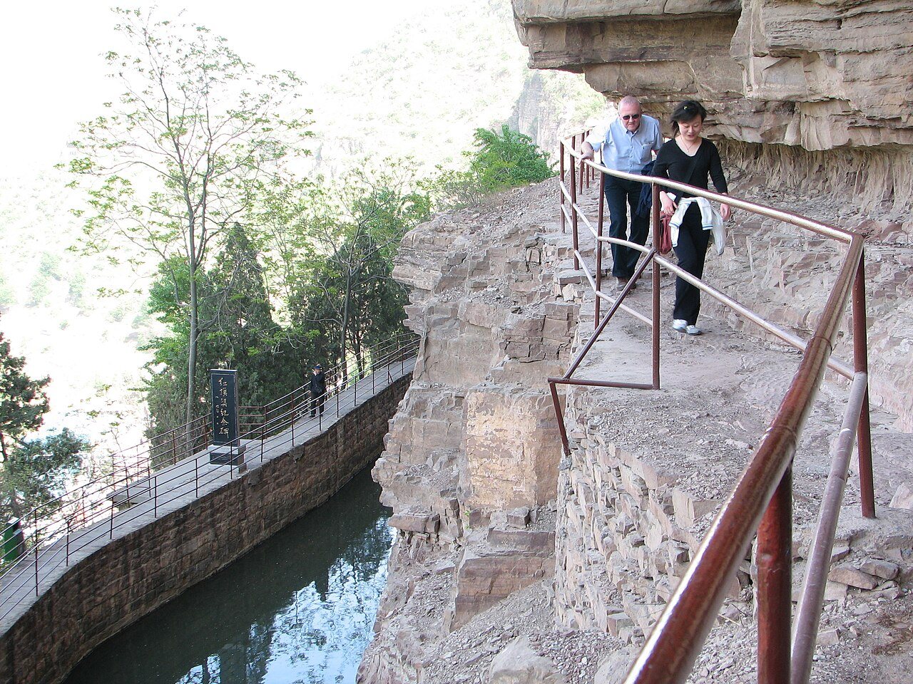
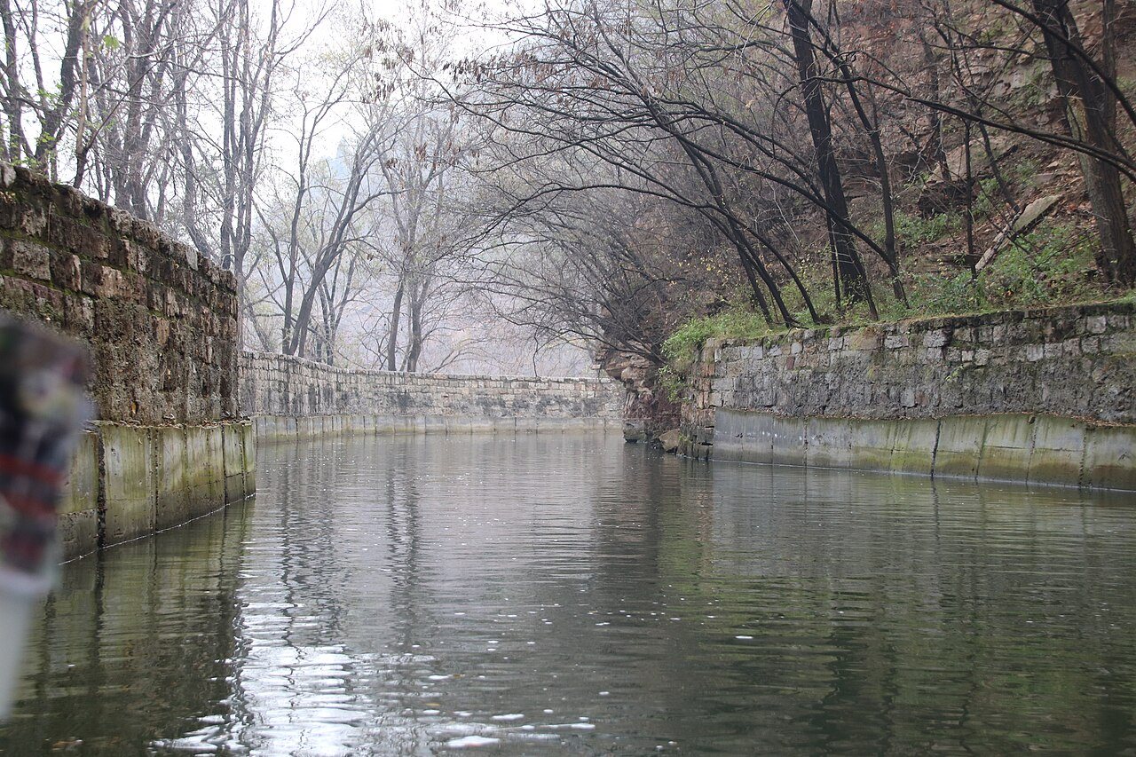
The Red Flag Canal, Hongqiqu, is an irrigation canal cut along the cliffs of the Taihang Mountains in Linzhou, about 80 kilometres northwest of Anyang. In the 1960s the people of what was then Lin County dug it largely by hand to bring water from the Zhang River into a district that had suffered drought for centuries. Its main channel clings to the mountainside for about 70 kilometres, and Chinese writers nicknamed it the man-made river in the sky. Today the canal is a national protected site and a 5A scenic area, visited both for its dramatic setting and as a monument to self-reliance in the Mao era.
Why Lin County needed water
Lin County sits on the eastern slopes of the Taihang range, where rock lets rain drain away and groundwater is scarce. Chinese Wikipedia cites county records counting some four hundred drought years since the Ming, and says that more than 300 villages carried water over the hills, some walking ten or more kilometres a day. The plan, first called the project to bring the Zhang into Lin, was to tap the Zhang River near the point where Shanxi, Henan and Hebei meet and lead its water along the mountainsides into the county.
Work began in February 1960, during the famine years that followed the Great Leap Forward. The leader most associated with it is Yang Gui, then the county's Communist Party secretary. The main canal was completed in 1965, and the branch canals were finished in July 1969.
The numbers
The figures quoted by the Henan government give a sense of scale. The main canal runs 70.6 kilometres from Shicheng in Shanxi to Rencun in Henan. Including trunk and branch channels, the system totals about 1,500 kilometres. Builders levelled 1,250 hilltops, cut 211 tunnels, raised 151 aqueducts and moved some 22 million cubic metres of earth and stone. The English Wikipedia counts 42 tunnels on the main line alone. Official accounts record 81 deaths during construction, the youngest aged 17 and the oldest 60.
The canal transformed farming. By one 2004 report it had irrigated land for decades, solved drinking water for about 600,000 people and raised grain yields several times over. It also sharpened old disputes with villages downstream on the Zhang, which flows on into Hebei, and the central government later set up a joint authority for the upper river to settle conflicts over water. The Italian director Michelangelo Antonioni filmed in Lin County for his 1972 documentary Chung Kuo, Cina, and the canal appeared in Chinese films and propaganda for decades.
The scenic area
The visitor site has three parts. Fenshuiyuan, about 19 kilometres from the city, is where the main canal splits into three trunk canals. It holds the sluice gates, a memorial stele and the Red Flag Canal Memorial Hall. The new hall, opened on 1 May 2014, is shaped like a flowing red ribbon and tells the story in sections from the drought years to the finished canal, with more than 2,000 objects.
The Youth Tunnel area is the highlight. The Youth Tunnel is the longest tunnel on the main canal, roughly 616 metres through hard quartz sandstone. Some 300 young workers began it in February 1960 and broke through on 15 July 1961, after more than a year of blasting on short rations, and the poet Guo Moruo wrote its name in 1973. Around it the canal path runs along the cliff face past Tiger's Mouth Cliff, where Ren Yangcheng and his crew dangled on ropes to clear loose rock, and Shengongpu, where workers lived in cliff shelters. From the canal wall the drop to the valley is sheer.
Luositan, about a kilometre west of the Youth Tunnel, is a deep pool below a falls on the Zhang River. Boats run through a short gorge called the Little Three Gorges, and an iron-chain footbridge about 25 metres long links the Henan bank with Hebei.
Tickets and getting there
In July 2025 the operator's official site listed a ticket of 80 yuan covering the Youth Tunnel area and the memorial hall, with the Youth Tunnel shuttle, boats and other rides charged extra, and concessions for seniors, children, students and other groups. Its guide page gave daily hours of 8:00 to 18:00. Prices and hours can change, so check the day's notice or the official Red Flag Canal tourism account before you go.
Linzhou lies roughly 80 kilometres from Anyang by road. Long-distance buses link the two cities, and from Linzhou taxis or local buses reach Fenshuiyuan and the Youth Tunnel. Hiring a car for the day from Anyang is the simplest way to see all three parts.
A day plan
The operator suggests the memorial hall and Fenshuiyuan in the morning and the Youth Tunnel and Luositan in the afternoon. Expect three to four hours on site, plus the drive. With a second day in Linzhou you can add the Taihang Grand Canyon at Shibanyan, another 5A area with cliffs and waterfalls. Pair the canal with a day at Yinxu in the city, and see the Anyang travel guide for a full three-day plan.
Before you go
- The cliff paths are narrow, so do not crowd at the railings.
- Mountain temperatures swing between day and night, so bring a windproof layer.
- Summer sun on the cliffs is strong. Bring a hat and water.
- Winter can bring ice to paths in the gorge.
Frequently asked questions
How long is the Red Flag Canal?
The main canal is about 70.6 kilometres long, and the full network of trunk and branch channels is about 1,500 kilometres.
Was it really dug by hand?
Mostly. Workers used hand tools and blasting, with very little machinery, and the project took almost ten years.
Which part should I see if time is short?
The Youth Tunnel area, for the cliff path and the tunnel itself, plus the memorial hall if you want the history.
Can I visit from Anyang in a day?
Yes, with an early start and a car. It is a long day by public transport.
Sources
Facts in this article were checked against the following sources, retrieved 18 October 2026.
- Red Flag Canal, Chinese Wikipedia
- Red Flag Canal, English Wikipedia
- Henan government office in Guangzhou, Red Flag Canal profile
- Red Flag Canal tourism, ticket notice, July 2025
- Linzhou government, 5A scenic area profiles
- Anyang travel guide on this site
Photos are from Wikimedia Commons under the licences shown in each caption.