Baishan Travel Guide: Changbai Mountain, Tianchi and the Forest Counties
Baishan, "White Mountain", is named after Changbai Mountain, the volcanic range on the North Korean border that holds Tianchi, the Heaven Lake. Most people searching for Baishan are really planning a trip to the mountain, and that changes the plan: the city itself, in the Hun River valley, is a quiet base with few sights, while the mountain gates lie in its counties. The west slope is reached through Fusong County, the south slope through Changbai County, and the north slope across the border in Yanbian. Allow at least two days so a foggy morning does not cost you the lake, and sleep near the gate you plan to use.
How the mountain is divided
Changbai is a broad, dormant volcano with a summit crater about a dozen kilometres across. Its great eruption around 946 was one of the largest anywhere in the last two thousand years, and smaller eruptions followed in 1597, 1668 and 1702. Sixteen peaks over 2,500 metres ring the crater. The highest, on the North Korean side, is about 2,750 metres; on the Chinese side, Baiyun Peak at 2,691 metres is the highest point in northeast China. The crater holds Tianchi, about 9.2 square kilometres and up to 384 metres deep, the deepest lake in China. The Songhua, Tumen and Yalu rivers all rise here.
For visitors, the Chinese side has three main approaches, each with its own gate, shuttle buses and viewpoints:
- West slope, via Fusong County: a long stairway to a rim viewpoint over the lake, and the canyon of the Jinjiang River.
- South slope, via Changbai County: quieter, close to the border, with its own rim view.
- North slope, via Antu County in Yanbian: the busiest, with the road to the summit viewpoint and the walk to Changbai Waterfall.
Tickets and shuttles are per slope, so choose one before you book a hotel. The detailed pages for Changbai Mountain and Heaven Lake (Tianchi) cover the routes on the mountain.
When to come to Baishan
June to September is the main season for the crater lake, with mild days, wildflowers on the tundra and the most reliable access. Fog and cloud can hide Tianchi in any month, so build a spare day into your plan. Autumn colour comes early, from mid-September. Winter is long and very cold, with deep snow. Parts of the mountain close or open on restricted routes, but the ski resorts near Fusong run from about November to April. Rain is heavy on the mountain itself, well over a metre a year at higher levels, so pack waterproofs even in summer.
Getting in and where to stay
Changbaishan Airport, in Fusong County near the west slope, has flights from major Chinese cities and is the quickest way in. Baishan city has rail links toward Tonghua, and the north slope is reached most easily from Yanji. Gate towns such as Songjianghe (west slope) have hotels and restaurants; staying there lets you be at the gate when it opens. Stay in Baishan city only if you are passing through by train.
Places worth visiting
Tianchi (Heaven Lake)
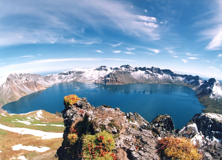
The lake is the reason to come. It lies on the border, with North Korea's half beyond the far shore, and it has been sacred to Manchu and Korean traditions for centuries. The Jurchen Jin rulers sacrificed to the mountain, and a stone altar of theirs survives on the north side. From the rim viewpoints you look down on a blue disc ringed by grey and ochre pumice peaks, if the weather allows. Check the summit forecast the evening before and again at dawn, go early, and be ready to switch to the forest walks if cloud closes in.
Forest belts
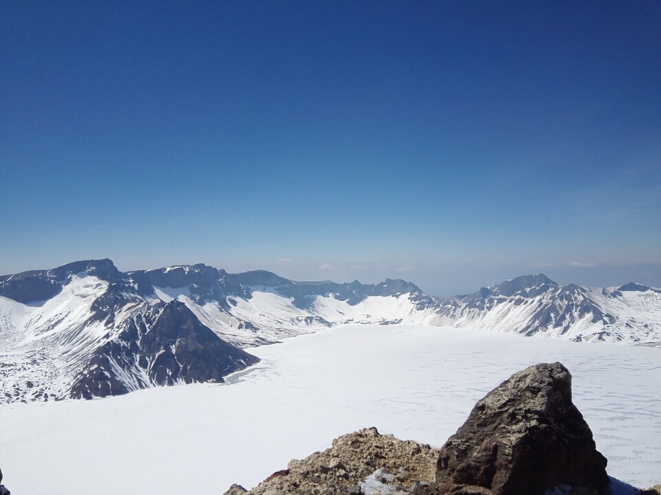
Climbing the mountain takes you through clear vegetation belts: broadleaf and mixed forest with Korean pine at the bottom, then spruce and fir, then birch, and finally alpine tundra above about 2,000 metres. The boardwalks in the lower forest are the best fallback on a foggy day and pleasant in their own right.
Changbai Waterfall
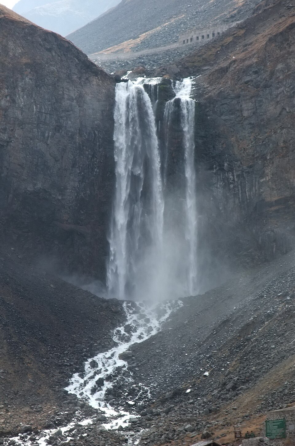
The waterfall drains Tianchi through a gap in the crater wall and feeds the Erdaobai River, the source of the Songhua. It is reached from the north slope and is often visited after the summit viewpoint, together with the hot springs near its foot.
Baishan city and the counties
Baishan was known as Hunjiang until 1994 and is the centre of a forest and mineral-water region. There is little for visitors in town beyond riverside parks. Fusong and Changbai counties are better bases, with ginseng markets and forest scenery on the way to the gates.
Eating in Baishan
The food is northeastern mountain cooking: stews of chicken and mushrooms, wild greens in season, pork with pickled cabbage and plenty of dumplings. Ginseng turns up in soups and shops everywhere. Korean dishes are common nearer the border and in Yanbian. Food inside the scenic area is limited and expensive, so carry snacks and water.
How to arrange the route
- Day one: fly into Changbaishan Airport or arrive by road, and check in at a gate town for the slope you have chosen.
- Day two: the mountain from opening time, including the rim viewpoint and the forest walks.
- Day three: a spare day for a second attempt on the lake if day two was foggy, or a different slope.
From here, head to Yanji for Korean-Chinese culture or to Tonghua and Ji'an for Goguryeo archaeology.
What to cut if short on time
Keep one full day on one slope with a spare morning for weather. Skip Baishan city, and do not try to do two slopes in one day. Leave Ji'an and Tonghua for another trip rather than squeezing them into a clear mountain day.
Things to confirm before you go
- Which slope's tickets and shuttle you are buying, and the current price; this guide does not quote 2026 fares because they could not be confirmed.
- The summit forecast and any closures for wind, fog or snow.
- Real-name booking rules and daily caps in peak season.
- That your hotel is near the gate you plan to use.
Frequently asked questions
Is Baishan the same as Changbai Mountain?
No. Baishan is the prefecture named after the mountain. The mountain gates are in its counties and in neighbouring Yanbian.
Which slope of Changbai Mountain is best?
The north slope is the most popular and includes the waterfall; the west slope has the long stairway to the rim and is easiest from Changbaishan Airport; the south slope is the quietest.
How many days do I need?
Two at minimum, three if you want insurance against fog.
Sources
The facts in this article were checked against the following Wikipedia and encyclopedia entries, retrieved September 21, 2026, and rechecked on October 14, 2026.
- Baishan https://en.wikipedia.org/wiki/Baishan
- Changbai Mountain https://en.wikipedia.org/wiki/Changbai_Mountains
- Changbai Mountain (Chinese) https://zh.wikipedia.org/wiki/长白山
- Heaven Lake https://en.wikipedia.org/wiki/Heaven_Lake
Scenic-area tickets and shuttle rules change; check the official notice for your slope before you go.
All photos are from Wikimedia Commons, used under CC licenses or public domain; re-use requires attribution.
- baishan-tianchi.jpg from File:Baitou Mountain Tianchi.jpg, by Bdpmax, CC BY-SA 3.0
- baishan-forest.jpg from File:Changbai Mountain,China.jpg, by Niuben, CC BY-SA 4.0
- baishan-waterfall.jpg from File:Changbai Waterfall.jpg, by xue siyang (df45086), CC BY-SA 3.0