Heaven Lake, the Crater Mirror on Changbai Mountain
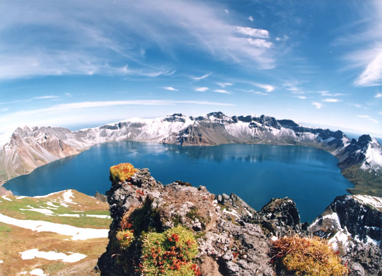
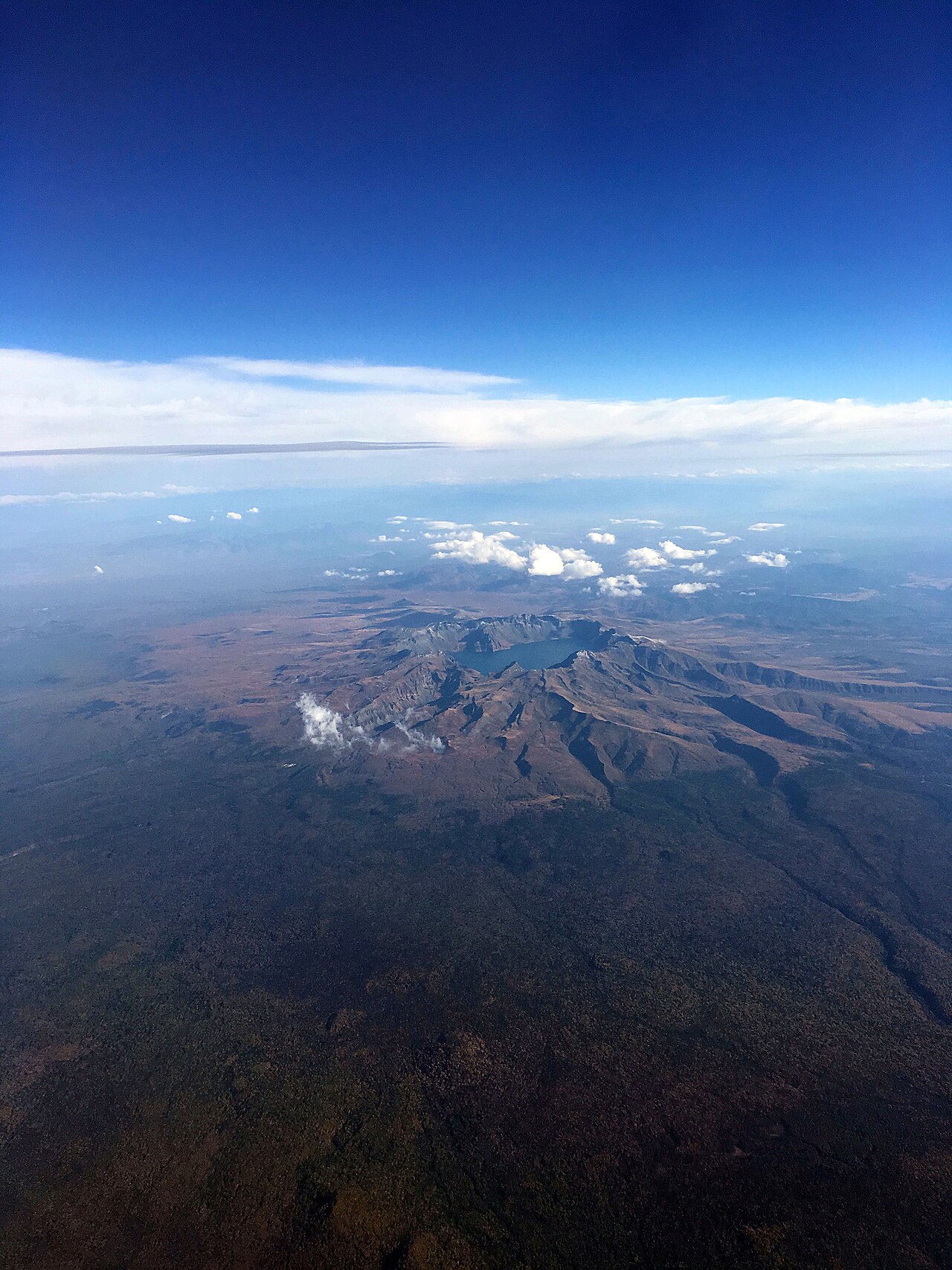
Heaven Lake, Tianchi in Chinese and Cheonji in Korean, is the volcanic crater lake on the summit of Changbai / Paektu Mountain. It straddles the China–North Korea border and is roughly divided between the two countries. English Wikipedia gives a surface elevation of 2,189.1 metres, an area of about 9.82 square kilometres, an average depth of 213 metres and a maximum depth of 384 metres. Chinese sources call it China's deepest lake and, in a 2000 Guinness recognition reported by People's Daily, the highest volcanic lake by altitude. Fog can erase the view any month. Treat the lake as weather-dependent, not as a guaranteed stamp.
How the crater formed
The caldera that holds Heaven Lake was created by the great 946 eruption of Paektu Mountain. Primary water input is precipitation; the Erdaobai River is listed among the outflows on the Chinese side, feeding the waterfall many visitors see lower down. From mid-October to mid-June the lake is typically ice-covered according to Wikipedia notes. Summer open water is the classic photograph; winter ice is a different product with different access rules.
Border geography matters for expectations. Looking across the crater, you are looking into another country. Stay behind posted lines and follow ranger instructions. Monster stories and propaganda legends circulate in media; they are folklore colour, not a reason to ignore safety signs.
Weather windows and planning
June to September is the usual outdoor window for crater views from the Chinese tourist gates. Clear forecasts still fail when summit cloud forms after you start the shuttle. Arrive early, accept that many tickets yield forest and waterfall days without a lake photo, and keep a buffer day if Tianchi is non-negotiable. The Baishan guide puts gate lodging ahead of long same-day stacks from Baishan city.
Tickets and shuttle rules change by season and gate. Invent no yuan prices; check the day's official notice. Private cars are restricted in core zones. Boardwalks and viewing platforms can be cold and windy even in July; carry layers and sun protection for thin high air.
Pairing with forest and waterfall
On a clear day, the lake is the priority. On a fog day, reverse the order: Changbai Mountain forest boardwalks and Changbai Waterfall still deliver a Northeast highland day. Do not force a Tonghua archaeology add-on onto a rare clear morning. County ginseng shops and Baishan urban parks are shopping or arrival buffers, not crater substitutes.
Cultural weight is heavy on both sides of the border. The mountain appears in Korean anthems and Qing origin stories. Moon Jae-in and Kim Jong-un's 2018 visit to the lake was widely reported as a symbolic pilgrimage. Travelers do not need that politics to enjoy the view, but it explains why the crater draws more than geology fans.
Getting there from the Baishan fringe
Baishan prefecture staging usually means transfers toward Fusong or Changbai county gates, with Antu-side access as another common Chinese approach. Confirm which gate your ticket names. Last shuttle returns matter before dusk. High-speed rail into the wider region still leaves a road transfer; read station names carefully.
What a successful hour looks like
When the crater opens, you may only get minutes of clear water before cloud returns. Move to the posted viewing line without lingering on unsafe edges. Wide shots establish the caldera; tighter shots pick wave texture or snow patches on the far rim. Group photos can wait until you have the landscape frame. Rangers close platforms in high wind; argue with weather, not with staff.
If the lake stays hidden, treat the day as a Changbai Mountain forest trip and keep morale. Many strong photographs from this region are of birch lines, waterfall spray and sea-of-clouds slopes rather than the crater disc itself. A second morning attempt, when lodging allows, doubles your odds more than racing between distant counties on the same clear afternoon.
Before you go
- Check summit weather at dawn, not only the night before.
- Dress for wind and cold at 2,000-plus metres.
- Keep a fog buffer day if the lake is mandatory.
- Follow border and boardwalk signs without exception.
- Confirm tickets and shuttles on the day's notice.
Frequently asked questions
Will I definitely see Tianchi?
No. Fog hides the lake often. Plan a buffer or accept a forest-and-waterfall day.
How deep is Heaven Lake?
Wikipedia lists an average depth of 213 metres and a maximum of 384 metres.
When does the lake freeze?
Sources commonly say mid-October to mid-June for ice cover. Winter visits need separate access checks.
Is the lake only in China?
No. It is a border lake shared with North Korea. Chinese tourist routes stay on the Chinese side.
Sources
Facts in this article were checked against the following sources, retrieved 13 October 2026.
- Heaven Lake, English Wikipedia
- 长白山天池, Chinese Wikipedia
- Changbai Mountains, English Wikipedia
- Mount Changbai Sets Two Guinness Records, People's Daily
Photos are from Wikimedia Commons under the licences shown in each caption.