Changbai Mountain, Volcano Forests on the Jilin Fringe
Changbai Mountain is what most travelers mean when they search "Baishan." The prefecture city is a forest hinge; the crater, tundra and waterfall labels sit mainly in counties such as Fusong and Changbai, with related access also from Antu in Yanbian. English Wikipedia places the range across Chinese Northeast provinces and the North Korean border, with Paektu / Changbai's main peak at 2,744 metres. The Chinese side is a major national scenic and nature-reserve destination. Tickets, shuttles and weather rules follow official notice; invent no yuan prices here.
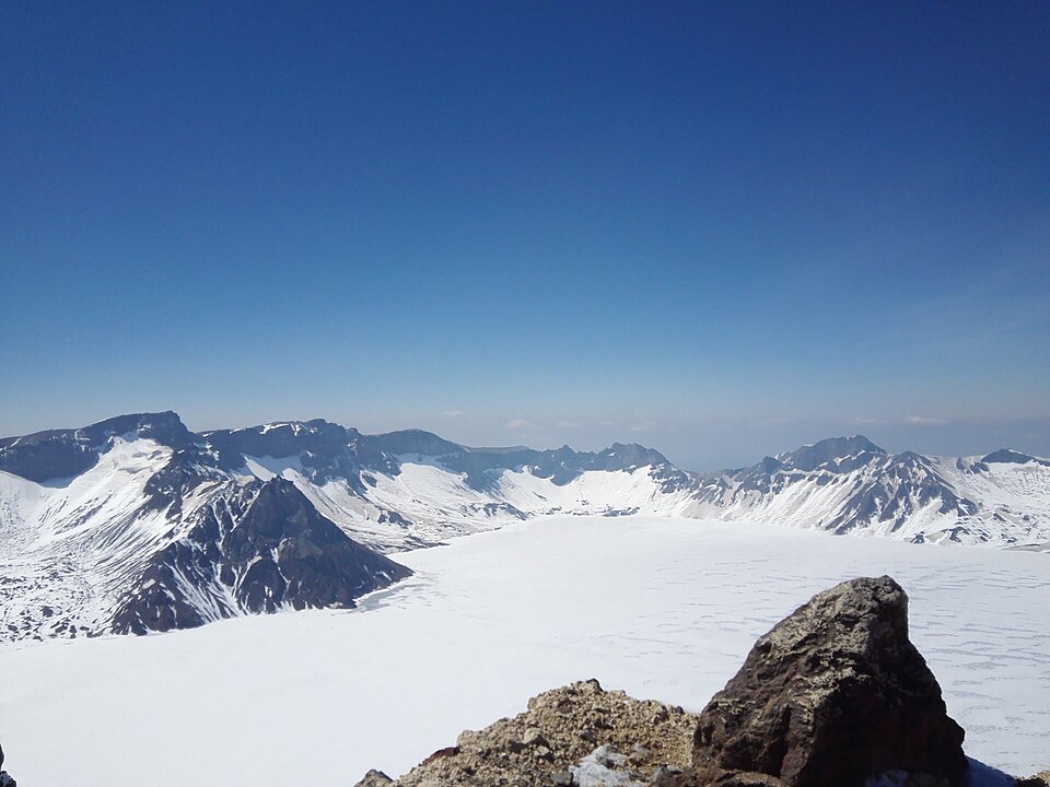
Naming and sacred geography
Chinese sources record older names such as Buxian and Taibai before the Liao and Jin use of Changbai. Manchu and Korean traditions treat the mountain as sacred. Qing imperial origin stories place ancestral myths near its lakes. Today the practical split for visitors is simpler: crater-lake weather days versus forest-boardwalk buffers. The Baishan guide warns against treating downtown parks as a substitute for highland views.
The mountain feeds the Songhua, Tumen and Yalu rivers. That hydrology matters less for a day ticket than for understanding why fog and snow arrive early.
Elevation zones and the waterfall
Vegetation changes with height. Above about 2,000 metres, tundra dominates. Birch and larch take over below the tundra, then spruce, fir and pine, then mixed and hardwood forests lower down. Boardwalks and shuttle roads sample these belts on the Chinese tourist routes. Changbai Waterfall, where water leaves the crater system toward the Erdaobai River, is the usual secondary label after Heaven Lake. Forest fringe walks fill fog days when the summit road is closed or the crater is socked in.
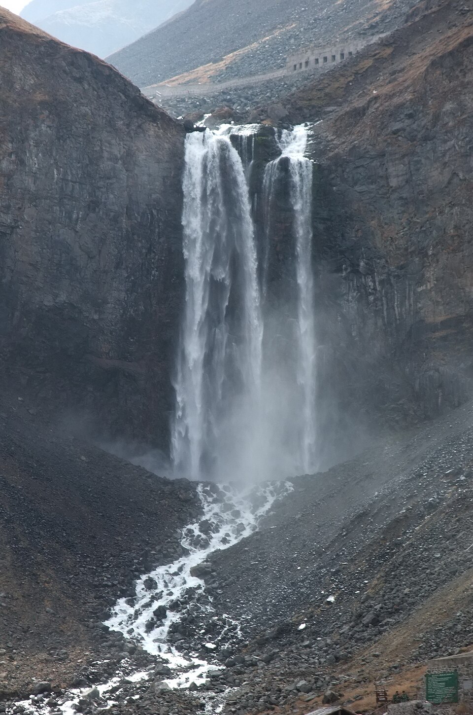
Arrive early on clear forecasts. Follow posted shuttle and boardwalk rules. One focused crater-and-forest block beats inventing every secondary waterfall label in one exhausted afternoon.
Season, gates and staging
June to September is the classic outdoor window for crater views; fog can erase Tianchi any month. Autumn colour comes early. Winter ice and snow change access and create a different tourism product; verify current notices. Weekdays ease peak summer queues.
Stay near a Changbai gate if Tianchi is non-negotiable. Stay in Baishan city if you are connecting rail and only sampling forest fringe. Gate-area lodging is wiser than a long same-day city–summit stack. Transfers need confirmed last returns before dusk forest walks.
Baishan links southeastern Jilin corridors toward Tonghua and Yanji routes. Skip forcing a Tonghua Ji'an archaeology stack onto the same rare clear Tianchi morning. Keep archaeology for another day; keep Changbai weather windows sacred.
Pairing with Heaven Lake
Heaven Lake (Tianchi) is the crater prize. Changbai Mountain as a whole is the forest, waterfall and logistics frame that makes the lake visit possible. On fog days, reverse the priority: waterfall and boardwalks first, summit attempt only if the notice reopens. The Baishan guide puts urban parks as soft arrival buffers only.
Practical pacing on a clear day
A typical Chinese-side summer pattern is an early shuttle toward the crater viewing area, time on the rim platforms if the cloud lifts, then a descent toward waterfall and forest stops. Midday can still work when morning fog burns off; late afternoon light is softer but shuttle cutoffs arrive sooner. Eat before you enter the gate zone if restaurant hours inside are thin. Carry water; highland air dries you out faster than city streets.
Photography from the rim is often into strong backlight or haze. A short lens for the lake disc and a longer one for ridgelines both help. Drones follow scenic-area bans; do not launch where signs forbid it. Winter photography is a separate kit list with ice traction and extreme cold layers.
If your group splits mobility needs, send stronger walkers to the higher platforms while others stay on gentler boardwalk loops, then regroup at a posted shuttle node. Keep phone battery warm in an inner pocket; cold drains power on the rim.
Before you go
- Watch the summit forecast the night before and at dawn.
- Book gate lodging when the crater is the thesis.
- Confirm shuttle and ticket rules on the day's notice.
- Carry layers; highland wind is cold even in July.
- Do not stack Tonghua archaeology onto a clear crater morning.
Frequently asked questions
Is Baishan city the same as Changbai Mountain?
No. Baishan is the prefecture hinge. Changbai's main tourist gates sit in surrounding counties.
How many days?
One clear full day for crater and waterfall with transfers. Two days if fog is likely.
Can I drive to the crater rim?
Tourist access uses scenic shuttles and posted walking routes. Follow the gate's current rules; private cars are restricted in core zones.
Baishan or Yanji?
Yanji is a Korean-Chinese city base with different food and logistics. Changbai crater access can be staged from more than one side; pick the gate that matches your tickets.
Sources
Facts in this article were checked against the following sources, retrieved 13 October 2026.
- Changbai Mountains, English Wikipedia
- 长白山, Chinese Wikipedia
- Heaven Lake, English Wikipedia
- 长白山天池, Chinese Wikipedia
Photos are from Wikimedia Commons under the licences shown in each caption.