The Guoliang Tunnel
Guoliang is a stone-built village on a ledge high in the southern Taihang Mountains, in Shayao township of Huixian, a county-level city under Xinxiang. Until the 1970s the only way in was a stairway cut into the cliff. Then the villagers spent five years chiselling a road through the rock face themselves, with windows opening onto the drop. The Guoliang Tunnel, which Chinese signs call the "cliff gallery", is now the core of the Wanxian Mountain scenic area and a good reason to stay a night in the mountains.
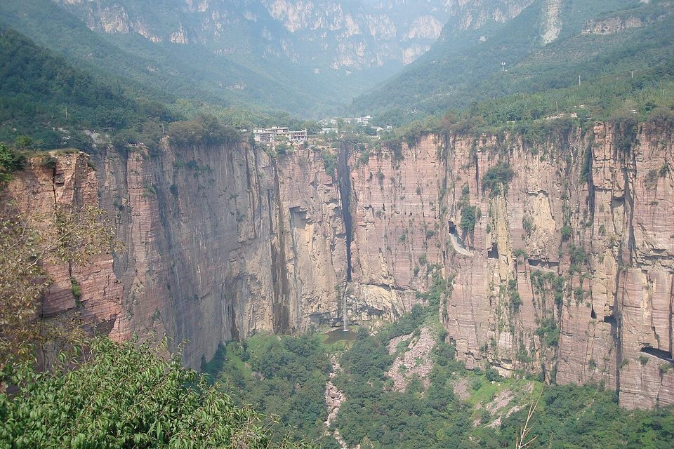
A village behind the cliff
English Wikipedia says the village takes its name from Guo Liang, a rebel of the Han dynasty who held off imperial troops in this terrain. Guoliang sits on three sides against mountains and on the fourth above a cliff. The rock is hard sandstone. Before the tunnel, the route down was a stone stairway first cut in the Ming and widened in the Daoguang reign of the Qing.
Five years with hammers
In autumn 1971 the village party secretary, Shen Mingxin, proposed cutting a road through the cliff. Work started on 9 March 1972. English Wikipedia records that the villagers sold livestock to pay for tools and materials, and that thirteen villagers began the digging. Without power tools, progress at the hardest stretch was about one metre every three days. At least one villager, Wang Huaitang, died during the work, and accounts differ on the total. The road opened to traffic on 1 May 1977.
The published dimensions disagree a little. Chinese Wikipedia gives 1,300 metres long, 5 metres high and 4 metres wide, with about 26,000 cubic metres of rock removed. English Wikipedia says 1.2 kilometres. The Xinxiang culture and tourism bureau gives 1,250 metres long, 6 metres wide and 4 metres high. The bureau also calls it the first man-made tunnel cut on the cliffs of the southern Taihang and the "father of Taihang tunnels". Windows punched through the outer wall light the passage and give the views that appear in most photographs.
Fame, film and the scenic area
A Japanese company filmed a documentary on the road in 1976, before it was even finished. The village has since become a film location, and the Xinxiang bureau counts more than 80 films and series shot around Wanxian Mountain, including the comedy Hands Up! (Juqi Shou Lai). Photos of the tunnel are often mislabelled online as Bolivia's Yungas Road, a mix-up Chinese Wikipedia also mentions.
Wanxian Mountain is a national 4A scenic area about 55 kilometres northwest of Huixian city and 70 kilometres from central Xinxiang. It covers 64 square kilometres and rises to 1,672 metres. It has two main sections, Guoliang with the tunnel and the cliff-top village, and Nanping in the valley below with waterfalls and the Danfen gorge. The area is also a national geopark and rock-climbing park. In 2020 a night lighting project for the tunnel was added, and the village street has guesthouses, food stalls and a red culture memorial hall.
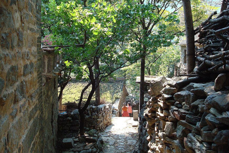
Walking the tunnel
Most visitors walk the gallery. Recent visitor reports give 30 to 40 minutes one way at an easy pace on a flat surface. Chisel marks still cover the walls. Scenic-area shuttle buses may share the road, so keep to the cliff side when one passes. Early morning and late afternoon light through the windows is best for photographs, and both times avoid the mid-morning tour groups.
Tickets, hours and getting there
The scenic area requires real-name booking and sells entry with a compulsory shuttle bus ticket that covers both sections. Travel sites reported in 2026 that private cars are kept off the gallery road during the day and must park at the visitor centre. Some village guesthouses arrange early or late access for guests. Prices and these rules change, so check the Wanxian Mountain official channels before you go. This page does not quote fares.
From Xinxiang, buses run to Huixian, where a scenic-area line continues into the mountains on a limited timetable. A hired car or taxi from Xinxiang station is simpler. The mountain road is narrow and winding near the top.
How long to stay
A day trip covers the tunnel and the village with time for one viewpoint. An overnight in Guoliang lets you walk the tunnel at dawn and see Nanping the next day. The Xinxiang bureau puts the average temperature about 6 degrees below the plain, a draw on hot summer days. Spring flowers and autumn leaf colour are the most photographed seasons. Winter can bring ice on the upper roads.
Before you go
- Book entry in advance and carry the ID you booked with.
- Wear shoes with grip for the cliff paths and stairways.
- Stay overnight if you want the tunnel without crowds.
- Combine with the Tomb of Prince Jian of Lu closer to the city.
Frequently asked questions
Can I drive through the tunnel?
Not during the day under the rules reported in 2026. Use the scenic-area shuttle or walk.
Is it scary?
The tunnel itself is wide and flat. Some outdoor viewpoints and the steep stairways nearby have exposed edges.
How far is it from Zhengzhou?
Most travellers go via Xinxiang. Allow a full day from Zhengzhou, or stay overnight.
Are prices listed here?
No. Entry and shuttle fares follow the official notice.
Sources
Facts in this article were checked against the following sources, retrieved 20 October 2026.
- Guoliang Tunnel, English Wikipedia
- 郭亮洞, Chinese Wikipedia
- Xinxiang Culture, Radio, TV and Tourism Bureau, Wanxian Mountain
- Xinxiang Culture, Radio, TV and Tourism Bureau, Guoliang leisure street
- Xinxiang travel guide on this site
Photos are from Wikimedia Commons under the licences shown in each caption.