Qinghai Lake, the Big Blue Water West of Xining
Qinghai Lake is the largest lake in China and the reason many people come to Xining at all. It lies about 100 kilometres west of the city in a basin of the Tibetan Plateau, between the Haibei and Hainan Tibetan autonomous prefectures, and the province takes its name from it. The water is salty and alkaline, the shore is grassland, and the surface sits at well over 3,000 metres. Most visitors see it as a long day from Xining or as the first stop on a loop farther west.
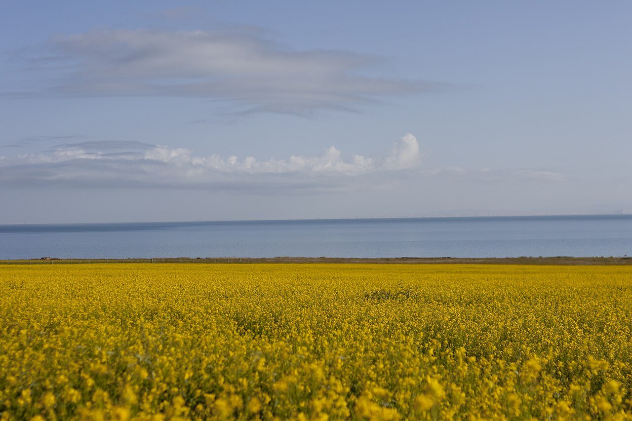
Blue sea, blue lake
Every name for the lake means roughly the same thing. Qinghai is Chinese for blue or green sea. Classical Chinese used one word, qing, for the range of colours between blue and green, so translations vary. The Mongolian name Koko Nor, which older English books use, also means blue lake, and the Tibetan name Tso Ngönpo was translated from it. English Wikipedia explains that calling a lake a sea comes from Mongolian usage, which did not separate the two.
How big it is, and why that keeps changing
The size depends on the year you ask about. English Wikipedia gives a surface area of 4,317 square kilometres, an average depth of 21 metres and a maximum of 25.5 metres for 2008. Chinese Wikipedia cites provincial survey figures showing that the lake shrank by about 254 square kilometres between 1974 and 2004, reached its smallest recent extent in 2005, and then grew again. By late September 2016, satellite monitoring by the provincial meteorology institute put it at 4,451 square kilometres, its largest since 2001. As the water dropped in the twentieth century, several smaller lakes split off around the edges, including Gahai in the north and Shadao and Haiyan in the northeast.
The altitude figure moves a little too, at around 3,200 metres, and English and Chinese sources give slightly different numbers. The lake has no outlet. Twenty-three rivers and streams flow in, most of them only in some seasons, and evaporation leaves the water salty, at a little over one per cent salt compared with about three and a half per cent for seawater. Geologists think it was cut off from the Yellow River around 150,000 years ago. Four ranges ring the basin, with the Datong Mountains to the north, Riyue Mountain to the east, the Qinghai Nanshan to the south and Xiangpi Mountain to the west.
Birds, fish and the island
The lake lies where several Asian bird migration routes cross. At the tip of the western peninsula are Cormorant Island and Egg Island, together called the Bird Islands, which have been protected since 1997. Chinese Wikipedia says more than 100,000 migratory birds use them in spring and summer, near the mouth of the Buha River, the largest inflow.
Only five native fish live in the lake. The most common is the naked carp, Gymnocypris przewalskii, a scaleless fish known locally as huangyu, together with four kinds of stone loach. Out in the water stands Haixin Shan, the island at the heart of the lake, which once had a Buddhist temple and hermitages. Monks and pilgrims could reach it only in winter, when the lake froze. Tibetan pilgrims still walk or ride around the whole lake, especially in Horse Years of the twelve-year cycle, and English Wikipedia notes that one walker took 23 days to finish the circuit.
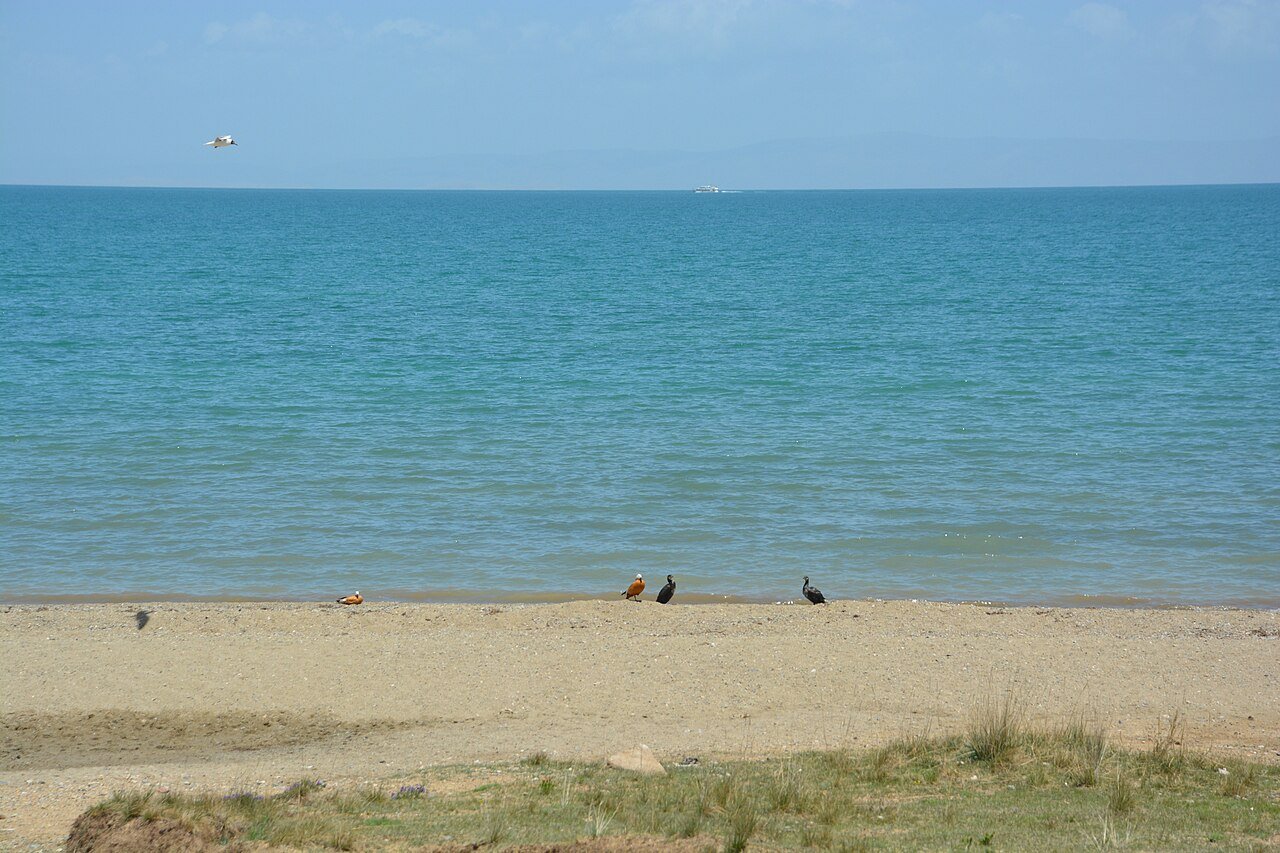
Where to see it
The lake is so large that you choose one stretch of shore rather than seeing all of it. Erlangjian, a ticketed scenic area on the southeast shore, is the closest developed stop to Xining and the usual target for day tours. It has boardwalks, a jetty and visitor facilities. Heimahe, at the southwest corner where the ring road turns, is known for sunrise views and is a common overnight stop for people driving on toward Chaka. Bird Island is on the far western side and is best seen in the spring and summer breeding season.
Erlangjian charges an entry fee that is higher in summer than in winter. 2026 travel reports quote around 90 yuan for the peak season and around 50 yuan off-season, with real-name online booking, but these come from news aggregators. Check the day's notice on the official booking channel before you go.
Getting there and the altitude
By road the drive from Xining crosses Riyue Mountain and takes around two and a half to three hours to the Erlangjian area, according to 2026 travel reports. Tour buses and shared cars leave Xining in the morning. A hired car with a driver is the easiest way to stop at viewpoints and turn back when you want. There is also a Qinghai Lake station on the Qinghai to Tibet railway, though the main visitor areas are on the south shore and most people go by road.
Plan for altitude. Xining sits at about 2,200 metres and the lake at about 3,200, so a day trip climbs a full kilometre. Drink water, move slowly on the first day and skip alcohol. Sun at this height is strong even when the air is cold, and the wind off the water can be bitter outside midsummer. In winter the lake usually freezes for about three months.
Fitting it into a Xining trip
The Xining guide treats the lake as an extra day after the city sights. Kumbum Monastery lies in the same southwest direction and makes a good first day before the lake. If you continue west, the Haixi guide covers the Chaka salt flats and Golmud. East of Xining, Haidong has shorter cultural stops.
Before you go
- Carry warm and windproof layers, sunscreen and sunglasses in every season.
- Book Erlangjian tickets in your real name if that is your stop.
- Give yourself at least one night in Xining before going up to the lake.
- Check road conditions in winter and spring, when snow can close the passes.
Frequently asked questions
How far is Qinghai Lake from Xining?
About 100 kilometres west in a straight line. Most day trips to Erlangjian take two and a half to three hours each way.
What is the altitude of Qinghai Lake?
Around 3,200 metres. English Wikipedia gives 3,205 metres and Chinese Wikipedia gives a slightly higher figure.
When do the rapeseed fields flower?
The yellow fields around the lake are a summer sight, usually best in July. Timing varies with the weather each year.
Can you swim in Qinghai Lake?
Swimming is not a normal visitor activity. The water is cold, salty and alkaline, and scenic areas set their own rules on entering it.
Sources
Facts in this article were checked against the following sources, retrieved 11 October 2026.
Photos are from Wikimedia Commons under the licences shown in each caption.