Flood Control Monument, Harbin: The End of Central Street
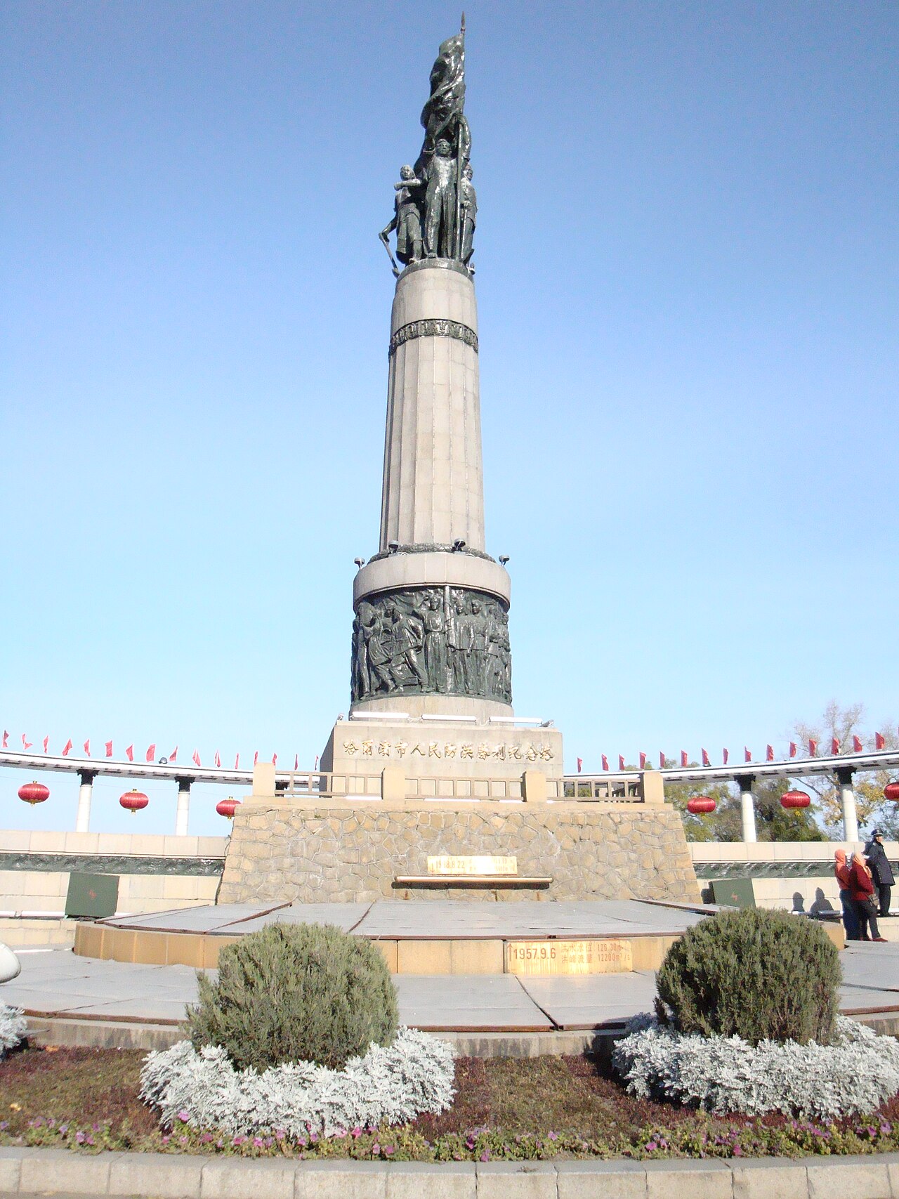
The Flood Control Monument (Fanghong Jinianta) stands where Central Street meets the Songhua River. You arrive at it at the end of the walk down the street anyway. Stop for fifteen minutes, read the reliefs, then climb onto the embankment and look at the river the monument is about. It is free and open at all hours, and it is lit at night along with the riverside promenade. In 1957 the Songhua rose in a catastrophic flood that threatened the whole city, and people from across Harbin went up onto the levees to hold it back. The monument was completed the following year, 1958, and it was listed as a protected cultural relic of Harbin in 1995. Pair it with St. Sophia Cathedral for a half day in Daoli, as in the Harbin travel guide.
What the monument shows
The monument is a granite column about 22.5 metres tall, ringed at its base by a semicircular colonnade of twenty Corinthian columns, and it faces up Central Street toward the old town. Look at the base for two marked levels. The lower one records the 1932 flood, when the river swamped much of Harbin and people rowed boats down Central Street. The upper one, a little over half a metre higher, records the 1957 crest that the city held back. The figures at the top and the reliefs on the shaft show the flood fight: people carrying earth, building up the dike and holding the line against the water. Even if you cannot read the Chinese inscriptions, the theme of collective labour is clear from the sculpture. It honours a civic effort, not a ruler or a battle.
That makes it an unusual stop in Harbin. Most of what visitors come for, from the onion domes to the ice castles, is about the city's looks. The monument is a reminder that the Songhua, frozen and decorative in winter and full of pleasure boats in summer, also threatens the city in flood years. The river still makes the news when it runs high.
Treat it as a memorial. It is not a climbing frame, and the steps should stay clear for people who have come to look.
On the embankment
From the monument, steps lead up to the top of the dike, where the riverside promenade runs along the south bank. From up there you can see how wide the Songhua is. Across the water lie Sun Island and the north bank, with the new districts beyond.
In summer the promenade fills with walkers, cyclists, street musicians and people fishing. Boats run river trips from nearby piers, and the Songhua River cableway and ferries cross to Sun Island. Timetables are seasonal, so check at the pier.
In winter the river freezes hard, and the wind off the ice is fierce. Activities on the ice are organised in designated areas in some seasons. Stay on the signed embankment and official areas, never on unmarked ice.
About a kilometre east along the embankment, through Stalin Park, is the old Binzhou railway bridge, a steel truss bridge finished in 1901 for the Chinese Eastern Railway. It was retired from rail service in 2014 and is now a pedestrian walkway, with glass decking beside the old rails. It is a good add-on in daylight if you want more railway history, and the walk takes about fifteen minutes.
Day or night
By day, the monument makes a good frame for photos looking back up Central Street, or out across the river. After dark the monument and the embankment lights come on together, making a gentle end to an evening after dinner on the street. Blue hour is the nicest time, if your camera battery has survived the cold.
There is nothing to book and nothing to pay. Take care crossing to the dike, and watch for ice on the steps in winter.
How long and how it fits
Allow fifteen to thirty minutes, more if you walk along the embankment. Do not make a separate trip across town for it. On its own it is too small to justify the ride, but as the finish of the Daoli walk it makes sense:
- Walk Central Street south to north.
- Detour east to St. Sophia Cathedral.
- Finish at the monument and the river.
- Turn back into Daoli for dinner, or cross to Sun Island in summer.
Because every taxi driver and map app knows the name, the monument is also Harbin's favourite meeting point. Tour leaders and friends arrange to "meet at the tower". In winter, arrive on time, because standing around in the river wind is no fun.
Practical notes
- Bring a windproof layer even in summer. The open dike is noticeably cooler than the street.
- Vendors and photo touts sometimes work the plaza, and a polite no is enough.
- On summer evenings, groups dance on the plaza. Join in or walk round them.
- The nearest metro station is Central Street on Line 2, then walk to the north end of the street.
Frequently asked questions
Why was the Flood Control Monument built?
To commemorate the 1957 Songhua flood, when residents across Harbin held the river back on the levees. It was completed in 1958.
Is the Flood Control Monument free?
Yes. The monument, the plaza and the embankment are free and open at all hours.
How long should I spend there?
Fifteen to thirty minutes, plus any walk along the embankment or out to the old railway bridge.
What else is nearby?
Central Street runs south from the monument, and St. Sophia Cathedral is a few minutes from the street. In summer, boats, ferries and the cableway cross the river toward Sun Island.